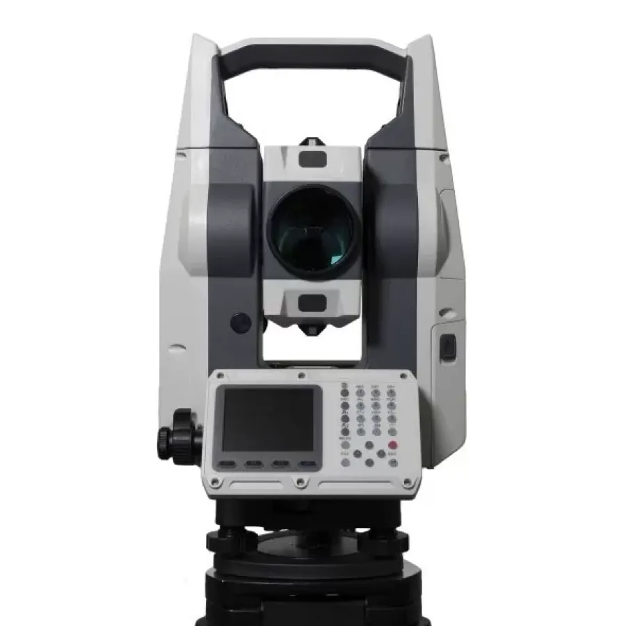
Total station EFT TS1 (500m)
The tacheometer is equipped with a durable housing reliably protected from the influence of external environmental factors, has a degree of dust and moisture protection IP66 and an operating temperature of -30°C.
USD · Volume pricing available
Categories:
Certifications
Global Shipping 7-14 Days
DHL, FedEx, UPS, Air & Sea
Genuine Products
Authorized distribution
Export License Ready
ECCN, CO, CI, PL, EUS docs
24/7 Tech Support
Pre & post sales
Export Compliance
EAR99AI confidence 50% · NLR — No license required. Standard end-use statement recommended.
Buyer Tier Benefits
Tier discounts stack with volume pricing. Automatically applied after your first order.
Buy a reliable electronic total station EFT TS1 500m for precise geodetic measurements!
Equip your equipment fleet with high-precision tools. Electronic total station EFT TS1 is designed for measuring distances, horizontal and vertical angles. The device is equipped with a durable housing with dust and moisture protection IP66 and operates at temperatures from -30°C. This makes it an ideal choice for difficult field conditions.
-
High measurement accuracy. Angular accuracy is 2 seconds, which meets the most stringent surveying requirements.
-
Long range without reflector. Measure distances up to 500 meters in reflectorless mode, convenient for hard-to-reach objects.
-
All-weather protection IP66. The housing is reliably protected from dust and water jets, which guarantees operation in all weather conditions.
-
Wide operating temperature range. The device operates stably at temperatures from -30°C to +60°C, and is suitable for use in harsh climates.
-
Wireless data transmission. The built-in Bluetooth module allows you to transfer measurement results to external devices without unnecessary cables.
How does this surveying tool work?
The principle of operation of the tacheometer is to measure the angles of rotation of the line of sight of the telescope in the horizontal and vertical planes. At the same time, the laser rangefinder measures the distance to the object. Based on the data received, the device calculates the exact coordinates of a point on the ground. Information is displayed on a color display on both sides of the case. Measurement results are saved in internal memory or to a USB flash drive.
Specifications
- Angle measurement method Hz and V: absolute, continuous, diametrical
- Angle measurement accuracy Hz and V: 2″
- Angle measurement resolution, ″: 1″
- Tilt Compensator Type: Dual Axis Fluid Tilt Sensor
- Compensator operating range: ±3′
- Compensator installation accuracy: 1″
Measuring distances
- Range: from 0.5 m to 6000 m (prism mode); from 0.5 m to 1000 m (film mode); from 0.5 m to 1000 m
- (mode “without prism”)
- Accuracy: 2 mm + 2 ppm (prism mode); 2 mm + 2 ppm (film mode); 3 mm + 2 ppm (mode “without
- prisms")
- Time (repeat/tracking): 0.5 s / 0.3 s (prism mode); 1 s (non-prism and film modes)
Spotting scope
- Image: straight
- Magnification: 30x
- Field of view angle: 1° 20′
- Lens diameter: 50mm
- Pipe length: 166mm
- Focus range: 1.5 m to infinity
- Reticle: Adaptive Backlight
- Resolution: 3″
General characteristics
- Control panel: 2-sided
- Display: 2.8″, color, 240×320 pixels (8 lines), adjustable backlight level
- Keyboard: alphanumeric, 28 backlit keys + trigger (measurement recording side key)
- Guide screws: fixing
- Target designator: yes
- Center: laser, 4 brightness levels
- Temperature and pressure sensor: automatic detection and recording of temperature and
- atmospheric pressure
Communication and data storage
- Communication capabilities: 1 RS-232 port, 1 USB 2.0 port
- Wireless: Bluetooth
- Internal memory: 20,000 points + USB flash (up to 4 GB)
- Software (built-in): survey, stake out, intersecting, blind distance, measure
- area, inaccessible height, road, reference line, reference arc. COGO: forward/inverse problem,
- intersection, offset, line alignment
- Software (external): Controlled by EFT Field Survey software
- Data format (export): .txt, .csv, .dat, .gt7, .htf, .GSI, .dxf, .SDR33
- Data format (import): .txt, .csv, .GSI, .dxf, .NCN, .CASS, .gt7
Electrical characteristics
- Battery: internal rechargeable EFT (EFT TS1; Type-C; 7.4 V, 3.1 Ah) - standard (2 V
- set); EFT M4 (7.4 V, 6.8 Ah) – option
- Operating time: 18 hours (measuring angles and distances every 30 seconds at 25°C); 36 hours (continuous
- angle measurement at 25°C)
- Full charge time: 2 hours 30 minutes
- External power: yes (optional)
Hardware specifications
- Dimensions: 200×212×372 mm
- Weight with battery and tribrach: 5.6 kg
- Operating temperature: from -30°C to +60°C
- Storage temperature: from -40°C to +70°C
- Dust and moisture protection: IP66.