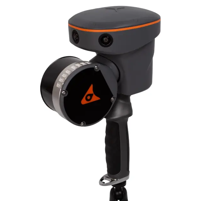
Laser scanner CHCNAV RS10 32
The CHCNAV RS10-32 mobile laser scanner is a universal platform that allows you to perform SLAM scanning both indoors and outdoors. Suitable for specialists in the field of geodesy, construction, architecture and surveying, who are often faced with the need to carry out accurate measurements in difficult conditions.
USD · Volume pricing available
Categories:
Certifications
Global Shipping 7-14 Days
DHL, FedEx, UPS, Air & Sea
Genuine Products
Authorized distribution
Export License Ready
ECCN, CO, CI, PL, EUS docs
24/7 Tech Support
Pre & post sales
Export Compliance
6A005AI confidence 65% · Export license may be required depending on destination and end-use.
Buyer Tier Benefits
Tier discounts stack with volume pricing. Automatically applied after your first order.
Choose the CHCNAV RS10 32 mobile laser scanner for complex geodetic tasks!
Get a universal platform for SLAM scanning indoors and outdoors. The CHCNAV RS10 32 laser scanner is designed for professionals in geodesy, construction and architecture. The device generates 640,000 points per second with a range of up to 300 meters. High-precision 5 MP cameras capture color information. Choose a reliable tool for work in any conditions.
-
SLAM technology with 32 channels. Scans without GPS indoors and outdoors.
-
Speed 640,000 points/sec and range 300 m. Rapid collection of detailed point clouds.
-
Relative accuracy 1 cm. High precision for engineering and architectural applications.
-
Three 5 MP cameras (2592×1944). Coloring the point cloud in real colors.
-
Full cycle of processing in software. Linking, stitching, drawing, auto-extracting and staking out.
How does this mobile laser scanner work?
CHCNAV RS10 32 uses SLAM (simultaneous localization and mapping) technology. The device scans space with 32 laser channels with a wavelength of 905 nm. The field of view is 360° horizontally and 270° vertically. Built-in GPS/GLONASS/GALILEO/BeiDou modules provide global connectivity. SLAM algorithms allow you to work in rooms without a satellite signal. Three cameras capture textures to color the point cloud.
The collected data is saved in .rcp format on a 512 GB drive. Control and processing are performed in SmartGo, CoPre, CoProcess and LandStar software. The battery provides 1 hour of continuous operation. IP64 rating protects against dust and splashes. Operating temperature range from -20 to +50 °C.
The CHCNAV RS10 32 scanner is ideal for building inventory, monitoring construction sites, historical monuments, mine workings and tunnels. It is effective wherever you need fast and accurate 3D shooting in difficult conditions.
Specifications
- Scanner type: SLAM (32 channels)
- Scanning speed: 640,000 points/sec
- Measuring range: 300 m
- Relative accuracy: 1 cm
- Laser wavelength: 905 nm
- Field of view: 360° x 270°
- Compensation system: —
- Camera: 5 MP x3 (2592 x 1944)
- Navigation: GPS, GLONASS, GALILEO, BeiDou
- Interfaces: USB
- Memory: 512 GB
- Data format: .rcp
- Software capabilities: point cloud snapping, stitching, rendering, auto-extraction,
- filming, location shooting
- Control: SmartGo, CoPre, CoProcess, LandStar software
- Power: Li-Ion battery
- Working time: 1 hour
- Operating temperature range: -20°C to +50°C
- Degree of protection against dust and moisture: IP64
- Dimensions: 178 x 126 x 213 mm
- Weight: 1.9 kg.