
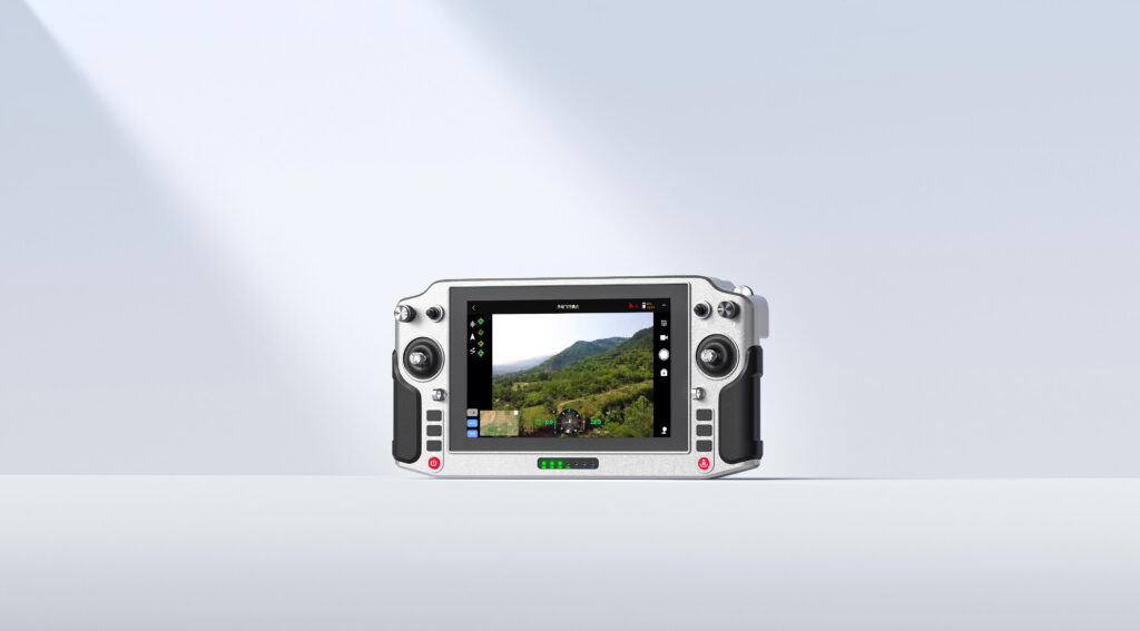
Display the enemy and friendly situation, coordinate the actions of allies and neighbors, and quickly guide strikes. Achieve a ‘clear overview on a single map’ of the battlefield situation and a ‘point-and-order’ method for issuing coordinated missions of forces and firepower. Ensure that tanks, infantry fighting vehicles, and other close-range direct-aim weapons can carry out long-range precision indirect-aim strikes on targets.
Main Function:
1. Display the enemy and friendly situation and neighboring missions on a 3D map.
2. Display accurate target coordinates, real-time target images, or real scene photos.
3. ‘One-click order’ to quickly and accurately issue reconnaissance, maneuver, and strike commands.
4. ‘One-click acceptance’ for direct-fire weapons guided by target images and indirect-fire weapons guided by target coordinates.
5. Remotely detect target coordinates.
6. Automatically calculate and guide fire control parameters, with an error within 1 mil.
Basic functions:
1. Coordinate type: Geodetic 2000
2. Coordinate resolution: 1 meter
3. Video channels: 8
4. Compatible vehicles: Type 96, 99, 15 tanks, Type 04, 07, 11 infantry fighting vehicles, and various self-propelled artillery models
5. Target coordinate positioning error: ≤5m
6. Fire parameters calculation error: ≤0.1 mil
7. Fire parameters setting error: ≤1 mil
8. Time to complete firing preparation: ≤1 minute
9. Real-time imagery and coordinate data compatible with unified integrated command platforms
Hardware specifications:
Operating time: ≥3 hours
Rated working voltage: 12V
I/O Port 1: USB1
I/O Port 2: USB2
I/O Port 3: LAN (RJ45)
I/O Port 4: HDMI
Video input: HDMI, UVC
Positioning data input: Beidou serial port
Data conversion interface: JY27184T10B35PHN
Data conversion interface: F1031T03J012-130
Beidou coordinate positioning error: 5 meters
Coordinate data conversion format: CGCS2000
Coordinate data update and distribution delay: 1 second
Video update and distribution delay: 300ms