
Mobile Command Terminal Application Software
Android tablet application software, integrating visual communication and drone video sharing functions.
PC-based Integrated Management and Scheduling Software
PC-side application software, integrating command and dispatch with beyond-visual-line-of-sight drone flight control functions, built into the dispatch console.
Empowering Smart Emergency Response | Xino Wheatfield Officially Joins the DJI Ecosystem
Breaking News | Sino-Maize Field Releases Beyond-Visual-Range Air-Ground Collaborative Command and Communication System 2.0
Breaking News | Sino-Maize Field Releases Beyond-Visual-Range Air-Ground Collaborative Command and Communication System 2.0
Breaking News | Sino-Maize Field Releases Beyond-Visual-Range Air-Ground Collaborative Command and Communication System 2.0
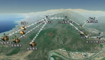
AEGISKY Transparent Battlefield Order-based Reconnaissance and Strike Coordination System
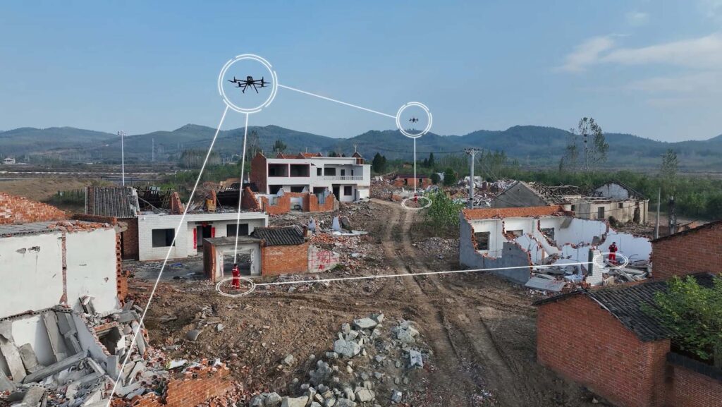
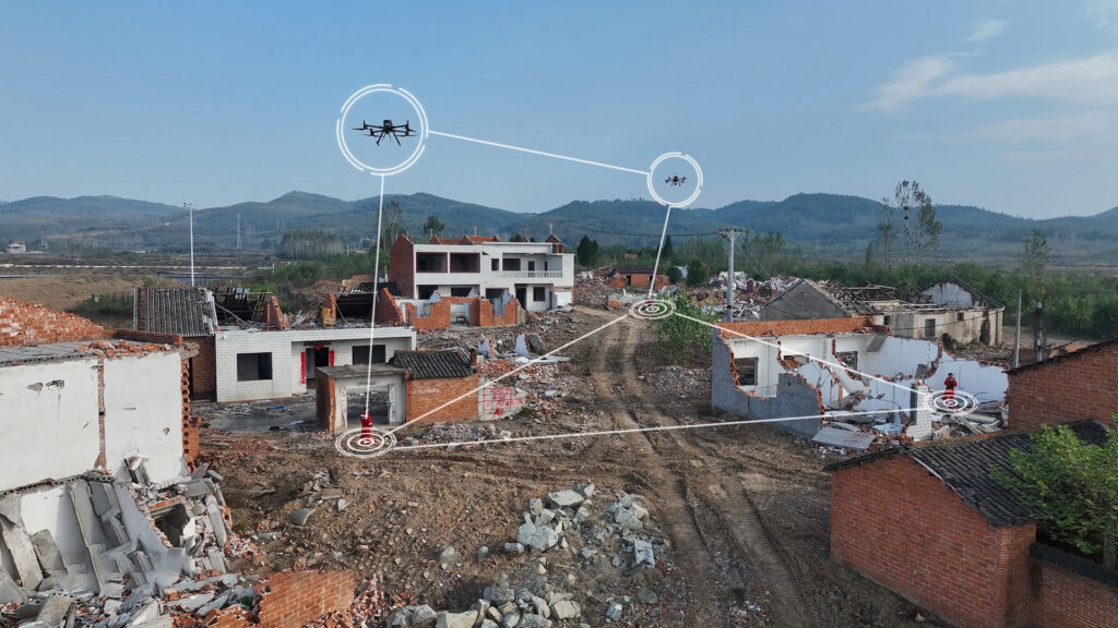
The beyond-visual-range air-to-ground collaborative communication system is deeply integrated with DJI drones. By building an integrated air-to-ground communication network, it effectively addresses the core challenges in emergency rescue under the ‘three disconnections’: poor audio and video transmission, information silos with no sharing, and lack of comprehensive situational awareness, providing support for various types of emergency rescue operations.
Human-machine guided indirect power
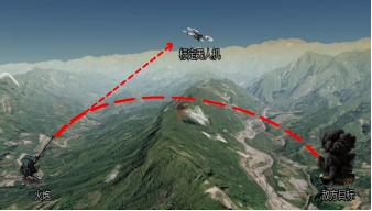
Recently, a State Grid Corporation of China power unit conducted a live-fire drill for power repair and personnel search and rescue in mountainous areas. The drill was conducted in a complex scenario involving power outages, disconnections, and disruptions at altitudes ranging from 500 to 1200 meters. The mountainous terrain presented significant elevation changes, and the […]
Battlefield situation data link
https://www.youtube.com/watch?v=XHOmBV4js_E Recently, a State Grid Corporation of China power unit conducted a live-fire drill for power repair and personnel search and rescue in mountainous areas. The drill was conducted in a complex scenario involving power outages, disconnections, and disruptions at altitudes ranging from 500 to 1200 meters. The mountainous terrain presented significant elevation changes, and […]
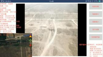
Real-time target positioning
https://www.youtube.com/watch?v=XHOmBV4js_E Recently, a State Grid Corporation of China power unit conducted a live-fire drill for power repair and personnel search and rescue in mountainous areas. The drill was conducted in a complex scenario involving power outages, disconnections, and disruptions at altitudes ranging from 500 to 1200 meters. The mountainous terrain presented significant elevation changes, and […]