UAV detection radar LRD AMP R 5000
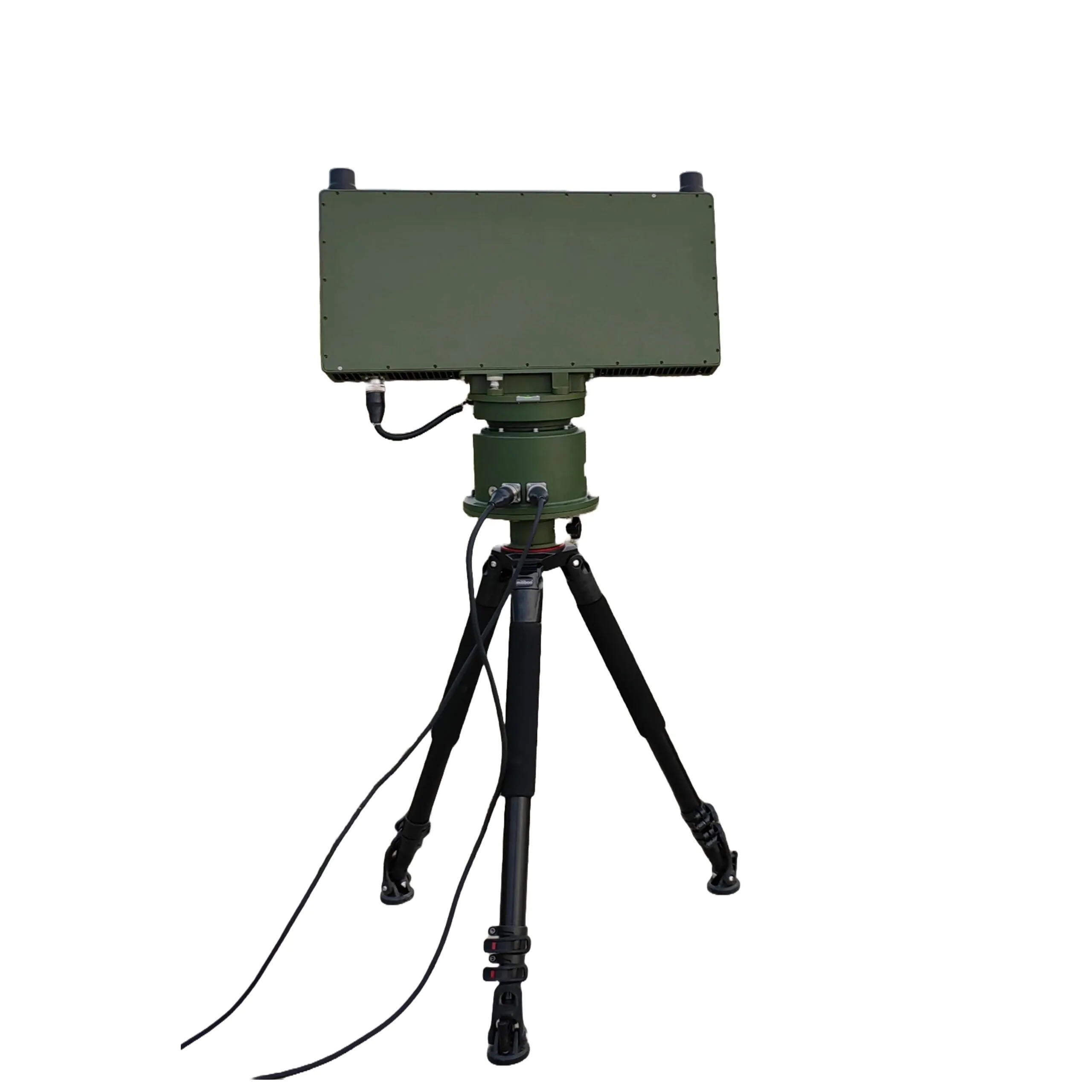
The radar for detecting UAVs at low altitude consists of a radar unit, a turntable and control terminal software. It is designed to detect and track targets - drones at low altitude, with the ability to transmit real-time information about the target: range, azimuth, altitude, speed, longitude and latitude.
USD · Volume pricing available
Kategori:
Certifications
Global Shipping 7-14 Days
DHL, FedEx, UPS, Air & Sea
Genuine Products
Authorized distribution
Export License Ready
ECCN, CO, CI, PL, EUS docs
24/7 Tech Support
Pre & post sales
Export Compliance
9A012AI confidence 75% · License required for certain destinations. License exceptions GBS/CIV may apply for allied nations.
Buyer Tier Benefits
Tier discounts stack with volume pricing. Automatically applied after your first order.
Radar for detecting UAVs LRD AMP R 5000 - its operating principle
The radar for detecting UAVs provides a 360° view of the airspace at low altitudes. Having received a command from the control terminal, the system activates the scanning mode. The rotating mechanism ensures continuous rotation of the radar in azimuth. At the same time, the radar beam scans a vertical sector from 0° to 30° in elevation. When an airborne object is detected, the system switches to its tracking mode. All target data is immediately transmitted to the control terminal.
Use Cases
-
Autonomous detection. The system is mounted on a tripod for stable operation. Independently detects and tracks drones within range.
-
Comprehensive protection. Integrates with optical cameras for visual target recognition. Compatible with electronic warfare systems to jam or disorient drones.
-
Flexible placement. Mounted on the roof of a vehicle for mobile patrolling. Installed on buildings for permanent stationary monitoring.
Key technical features
-
System type. Fully coherent pulse-Doppler.
-
Measuring coordinates. Determination of angular coordinates (azimuth, elevation) by comparing signals in the sum and difference channels in one probing pulse.
-
Signal processing. Application of coherent processing (MTD) to accumulate signals from moving targets and suppress interference.
-
Adaptation to disturbances. Using the CFAR algorithm to automatically adjust the detection threshold. This ensures a stable probability of false alarms in a changing interference environment.
Basic parameters
- Operating frequency range: Ku, 16 GHz ±150 MHz
- Scan method:
- Azimuth: 360° mechanical scanning
- Elevation scanning range: ≥30°
- Beam Width:
- Azimuth: ≤3°
- Elevation angle: ≤6°
- Peak transmitter power: ≤100W
- Detection range (DJI Phantom 3, 4, Pd=85%):
- Max. range: ≥5km
- Min. range: ≤250m
- Min. target speed: ≤2 m/s
- Measurement accuracy (RMS):
- Range: ≤10m
- Azimuth: ≤0.5°
- Elevation angle: ≤0.5°
- Data update rate for circular scanning: 3 s
- Dimensions:
- Radar: ≤650×400×100mm
- Radar + turntable: ≤650×650×250mm
- Power: +28 V
- Power consumption (including suspension): ≤300W
- Total weight (radar, gimbal, tripod): ≤3.5kg
- Interface: Gigabit network port
Software
Display and control software provides:
- Radar operation control
- Setting up operating parameters
- Radar data analysis
- Displaying targets
- Saving files with experiment results
- Converting data into formats required by the customer and transferring them to the client terminal


Radar display and control application interface
| № | Name | Qty | Unit change | Note |
|---|---|---|---|---|
| 1 | Radar unit | 1 | pcs | |
| 2 | Rotary table | 1 | pcs | |
| 3 | Tripod | 1 | pcs | |
| 4 | Directional antenna | 2 | pcs | |
| 5 | Cables | 1 | kit | Including power and communication, length 10 m |
| 6 | Fasteners | 1 | kit |