LiDAR Livox GEOSUN GS-200G
GNSS board: Unicore UM980
USD · Volume pricing available
Catégories:
Certifications
Global Shipping 7-14 Days
DHL, FedEx, UPS, Air & Sea
Genuine Products
Authorized distribution
Export License Ready
ECCN, CO, CI, PL, EUS docs
24/7 Tech Support
Pre & post sales
Export Compliance
6A005AI confidence 65% · Export license may be required depending on destination and end-use.
Buyer Tier Benefits
Tier discounts stack with volume pricing. Automatically applied after your first order.
Buy Geosun GS-200G lidar for professional 3D scanning!
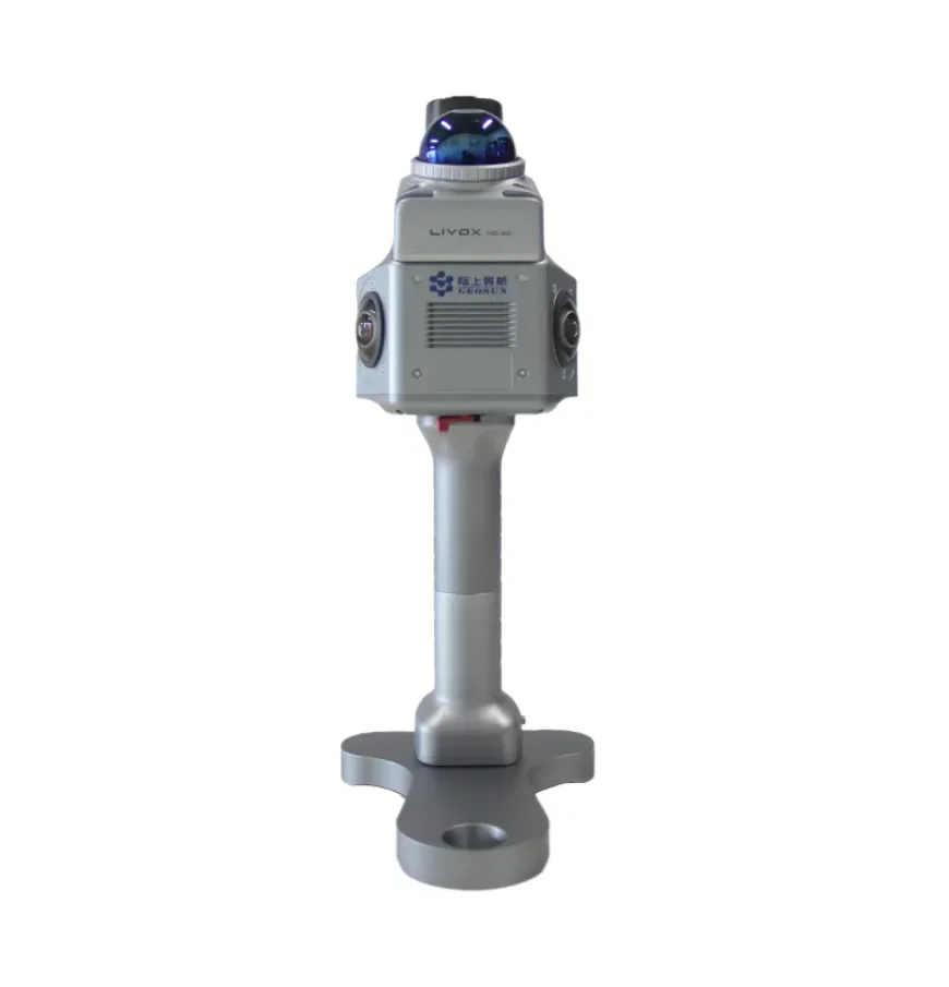
The Geosun GS-200G lidar is a portable system for high-precision mapping. The model is designed to work in the most difficult conditions. It is ideal for surveying, construction and BIM modeling.
- Weighs only 1 kg for comfortable, fatigue-free work.
- Full 360° view to scan any space.
- High accuracy up to 1 cm for detailed digital models.
- Autonomous operation up to 2 hours without recharging.
- Work without GNSS indoors thanks to SLAM algorithms.
Choose a portable scanner for fast 3D mapping
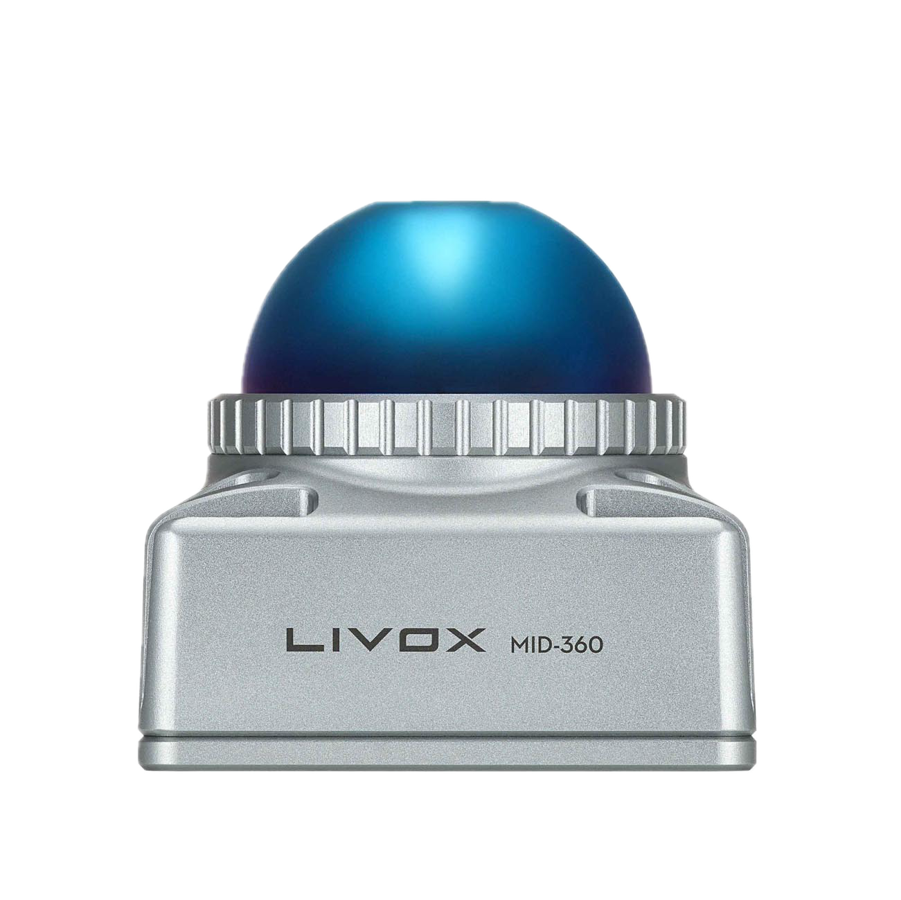
Geosun GS-200G lidar is built on the Livox Mid-360 sensor. This solution provides up to 200,000 points per second. The horizontal field of view is 360 degrees. Vertical view covers from -7° to +52°. Scanning range reaches 70 meters. The measurement accuracy at a distance of 10 meters is 2 cm. The relative accuracy of the point cloud is 1 cm. Absolute accuracy reaches 5 cm.
The device is equipped with a high-precision POS module gSpin 210. POS data update rate is 200Hz. Horizontal positioning accuracy is 0.02 meters. Vertical accuracy is 0.03 meters. Built-in battery with a capacity of 11600 mAh provides up to 2.5 hours of operation. System power consumption does not exceed 25 W.
A special feature of the model is the integration of lidar, GNSS and INS. The system operates in GNSS environments and is completely satellite-free. Advanced SLAM algorithms ensure stable trajectory. The scanner does not require ground control points. This greatly speeds up and simplifies the shooting process. The device supports SLAM, PPK-SLAM and RTK-SLAM modes. Two 20 megapixel cameras provide color snapping. Built-in 128GB MicroSD memory stores all data. The scanner operates at temperatures from -20°C to +55°C.
Choose reliable equipment from the manufacturer Geosun Navigation
Manufacturer Geosun Navigation is a Chinese company from Wuhan. It specializes in surveying and mapping equipment. Geosun products are known for high quality and innovation. The company offers affordable professional solutions for SLAM scanning. All devices undergo strict quality control. Geosun Navigation is actively developing technologies for digital twins.
The peculiarity of Geosun models is their versatility and mobility. GS-200G supports handheld, backpack and 车载 modes. The system is suitable for urban and industrial sites. It is effective for scanning mines and underground spaces. Ideal for BIM modeling and inspections. Fully integrated design requires no external cables.
- GNSS board: Unicore UM980
- Satellite constellations: BeiDou, GLONASS, GPS, Galileo, IRNSS, QZSS, SBAS
- SKP PPK: in plan 3.0 mm + 1.0 mm/km, in height 5.0 mm + 1.0 mm/km
- UPC RTK: in plan 8.0 mm + 1.0 mm/km, in height 15.0 mm + 1.0 mm/km
- Absolute accuracy: less than 5cm
- Relative accuracy: 1mm
- Scanning range: 0.5–70 m
- Field of view: 360° × 59°
- Scanning speed: 200,000 points/s
- Laser class: 1
- Wavelength: 905 nm
- IMU refresh rate: 200Hz
- Export formats: LAS, TXT
- Communication between scanner and GNSS: yes
- Real-time point cloud display: yes
- Data collection without closing polygons: yes
- Software for collecting geospatial data: yes
- Internal memory: 128 GB
- Camera: built-in, calibrated with scanner
- Number of cameras: 2
- Camera field of view: 200°
- Camera resolution: 2 × 20 MP
- Operating temperature: -30 to +55 °C
- Storage temperature: -35 to +65 °C
- Dust and moisture protection: IP64
- Battery capacity: 11600 mAh
- Battery life: 2 hours
- Scanner dimensions: 165 × 120 × 324 mm
- Scanner weight: 1 kg