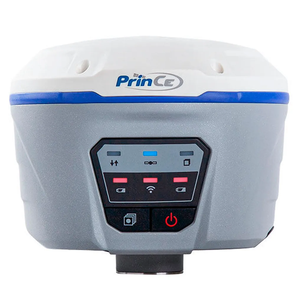
Geodetic satellite receiver PrinCe I50
The PrinCe i50 GNSS receiver is capable of operating on 576 channels, increasing the accuracy of the result, which is important when working in difficult conditions for signal reception.
USD · Volume pricing available
Kategorien:
Certifications
Global Shipping 7-14 Days
DHL, FedEx, UPS, Air & Sea
Genuine Products
Authorized distribution
Export License Ready
ECCN, CO, CI, PL, EUS docs
24/7 Tech Support
Pre & post sales
Export Compliance
7A003AI confidence 60% · NLR for most destinations. License required for D:1/D:5 countries.
Buyer Tier Benefits
Tier discounts stack with volume pricing. Automatically applied after your first order.
Order the high-precision PrinCe i50 GNSS receiver for professional geodetic work!
Provide yourself with a reliable tool for surveying and construction. The PrinCe i50 GNSS receiver is capable of processing signals from 576 channels simultaneously. The device works with all satellite systems: GPS, GLONASS, BeiDou, Galileo and QZSS. You get stable communication even under dense treetops or in urban “wells”. Choose proven equipment for critical tasks. Order PrinCe i50 right now in our store.
-
576 universal channels. The receiver monitors all existing and future satellite signals.
-
Ultra-high precision RTK. The mean square error is only 8 mm + 1 mm/km in plan.
-
All-weather protection IP68. The magnesium alloy body is resistant to dust, water and drops from two meters.
-
Extreme temperature range. Operates without failure from -40°C to +75°C, which is ideal for the Russian climate.
-
Double correction transmission system. Built-in VHF (2 W) and 4G GSM modems provide communication anywhere.
How does this surveying tool work?
The PrinCe i50 GNSS receiver operates as a high-precision satellite station. It measures the travel time of the signal from the satellites to its antenna. Based on this data, the device calculates the exact distance and determines the coordinates. 576 channels allow you to simultaneously track the maximum number of satellites. Built-in signal processing algorithms provide a “fixed” RTK solution even in difficult conditions.
To transmit corrections, built-in VHF and GSM modems with a power of 2 W are used. This allows operation in base and rover mode without additional equipment. The electronic level compensates for pole tilt up to 30 degrees. You can measure points where it is impossible to position the pole vertically, such as the corners of buildings. Data is recorded to the 8 GB internal memory or transferred to the controller via Bluetooth and Wi-Fi.
The delivery set includes the receiver itself, two batteries, a radio antenna, cables, a charger, a plastic height measure, a tape measure, a durable transport case and LandStar 7 software. The device is included in the State Register of Measuring Instruments (No. 75443-19).
Specifications
- Received signals: GPS (L1C/A, L1C, L2C, L2P, L5), GLONASS (L1C/A, L1P, L2C/A, L2P), BeiDou (B1, B2, B3),
- Galileo (E1, E5A, E5B), SBAS, QZSS
- Number of channels: 576
- Static accuracy: Plan: 3.0 mm + 0.5 mm/km, Height: 5.0 mm + 0.5 mm/km
- Accuracy in RTK mode: Plan: 8.0 mm + 1.0 mm/km, Height: 15.0 mm + 1.0 mm/km
- Initialization time: Less than 10 seconds
- Initialization reliability: More than 99.9%
Communication capabilities
- Built-in modems: GSM (4G), transmit-receive VHF modem (range 410-470 MHz, power 0.1-2.0 W)
- Wireless: Bluetooth 4.0, Wi-Fi
- Wired interfaces: RS-232, USB
- Other: Web interface for remote management, SIM card slot
Physical parameters and nutrition
- Weight: 1.29 kg
- Dimensions: 140 x 130 x 106 mm
- Case material: Magnesium alloy
- Protection: IP68 (dust and waterproof, withstands 2 m immersion)
- Shock resistance: Withstands a 2m drop onto concrete
- Operating temperature: -40°C to +75°C
- Power: Two removable Li-Ion batteries of 3400 mAh, hot-swappable
- Operating time: up to 12 hours in static mode, up to 10 hours in RTK (GSM) mode
- Built-in memory: 8 GB
Additional Features
- Display: Front panel LEDs
- Software: Control via LandStar 7 software on Android
- Other: Built-in electronic level for tilt shooting, multipath suppression technology.