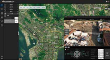
Flight Control:
Supports automatic and manual flight control, real-time monitoring of the drone and flight status, enabling beyond visual line of sight and non-line-of-sight flight control.
Map and Location:
Displays mission status, altitude, speed, flight distance, number of satellites, and battery level.
Flight Status:
Displays mission status, altitude, speed, flight distance, number of satellites, and battery level.
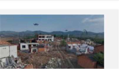
Drone Video:
Supports monitoring drone aerial videos, taking photos, recording videos, marking target coordinates, and identifying their nature. The drone can automatically track targets and engage them automatically.
Gimbal Operation:
Camera mode switching (wide-angle, zoom, infrared), gimbal adjustment (up, down, left, right), lens mode
Flight Path Planning:
Set flight speed, altitude, return altitude, end actions, lost-link actions, etc.
Records:
Supports flight history records, record searching, etc.